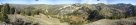
Central Wasatch Front
Excellent Boneville Shoreline trail for everyday spin and lung breaking rides in the Wasatch Mountains above Salt Lake City. Some trails in Wasatch are pretty good (not too steep, and locally technical), some ar just steep way up and brake all the way down.
Salt Lake Downtown area
Boneville Shoreline Trail downtown section
Big Mountain - Lookout Pk. loop
Emigration Canyon - City Creek Canyon loop
Mountain Dell - Parley's Canyon loop
Millcreek Canyon
Millcreek Pipeline
Millcreek Pipeline - Lambs Canyon trail
Upper Millcreek
Big Cottonwood Canyon
Solitude Resort
Wasatch Crest Trail
Days Fork
Brighton Resort to Alta and back
Little Cottonwood Canyon
Grizzly Gulch
Germania Pass
White Pine Lake Trail
Alta - Sugarloaf Pass - Mineral Basin - Hidden Peak Supertour
Little Cottonwood Pipeline
Oquirrh Mountains
Yellow Fork of Rose Canyon
Combo/epic rides
SLC to Big Mountain Pass, Parley's Summit and back
Lambs Canyon - Millcreek Canyon connection
From Salt Lake to Bountiful and back
More epic rides around SLC done from 2004 on
Salt Lake Downtown area
Boneville Shoreline Trail - downtown section
Boneville lake was a huge lake about 300 m above current level of Great Salt Lake, which emptied into Snake River a long time ago. The Wasatch Range formed its eastern shore, and the lake formed there an obvious bench. The Boneville Shoreline Trail tries to copy this bench. Plans are to have a continuous trail from Brigham City in the north to Nephi good 150 mi. in the south. Some sections of the trail are finished, the Salt Lake downtown section seems to be one of the longest. I am not sure how the trail will lead in the central part of Salt Lake valley, as the bench in this area is unfortunately already developed area. Probably the trail will lead on subdivision roads, as is the case already south of Emigration Canyon and in southern Bountiful.
The downtown part of Shoreline is the basic riding area for bikers living in downtown SLC. I have divided the trail in 3 sections, one section ride time is probably around about 1 hour one way, excluding optional spurs to the hills.
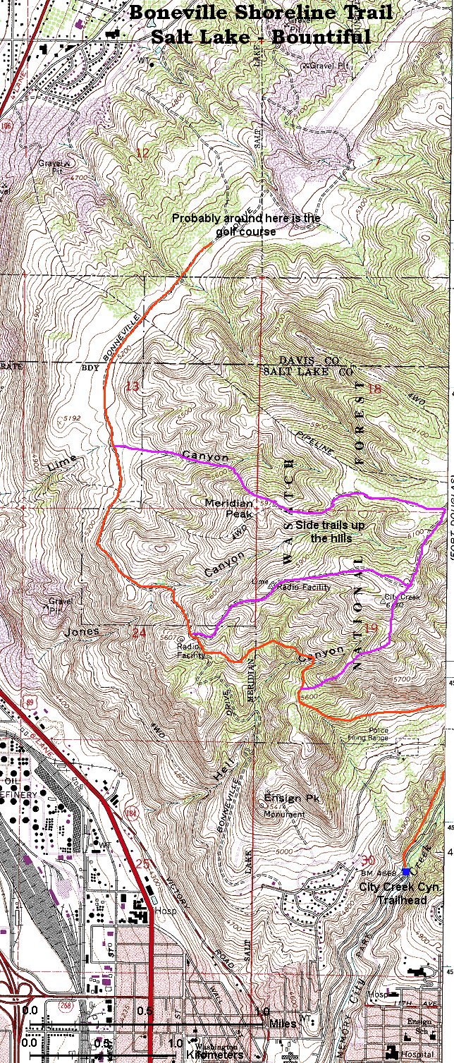
Section 1 - City Creek Cyn. to Bountiful
Trail map (620 kB)
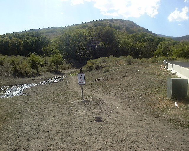
I have long neglected this part of the trail, only in fall 2000 I went out there a couple of times and explored. From City Creek, the trail climbs north and then west through a series of switchbacks to a saddle above North Salt Lake, and then contours north towards a set of radio towers. From here, one option is to climb all the way up to the highest tower and from here continue on a doubletrack east to destination unknown. The shoreline trail, not marked here, continues north downhill on a doubletrack right above the first radio facility. After few ups and downs, the doubletrack leads to an obvious flat bench with nice views of the northern Wasatch Front. Few hundreds meters from here starts the developed area, marked by a golf course populated by not-so-biker-friendly people, so it's time to turn around.
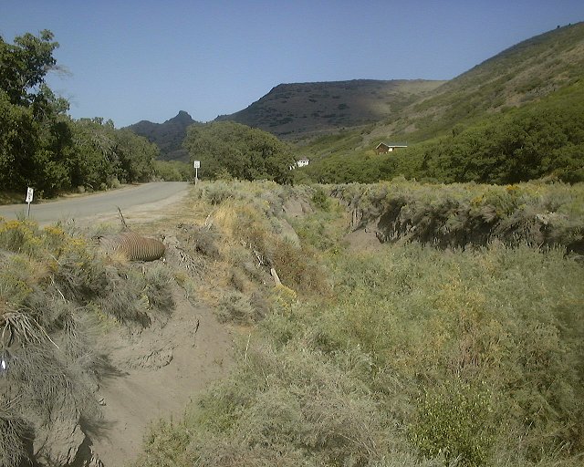
A year later, I have finally explored the ridge connection to Bountiful. Ride past the highest radio tower, heading north-east, for about 3 miles. The trail goes up and down on the ride on an old jeep road, that is very loose, with rocks up to head in size. Some steep pitches need to be pushed. The turn-off is on a well-defined intersection on a top of a small hill. One trail heads up the ridge directly east, the other descends west. The first part of the descent is very rocky, but once the trail hits the aspens, the trail smoothens up a bit, and is quite enjoyable. After about 1.5 miles, cross the main creek and drop down on a jeep and then paved road to Bountiful Blvd. Take it south past a golf course, and jump on the Shoreline trail to get back to SLC.
The total loop starting from the University area is about 38 kms. long, elevation gain about 1250 m. The ridge requires good lungs and bike handling skills, so, don't try this if you lack one of these.
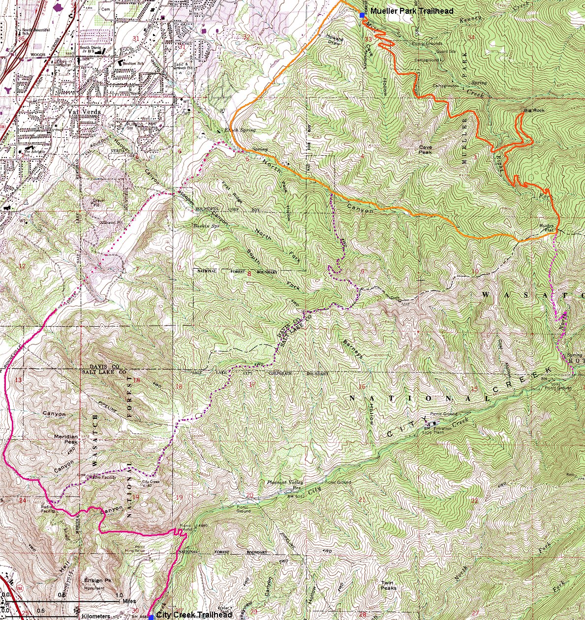
Here is the 24k map of the area from City Creek to Mueller Park in Bountiful (880 kB)
Fotos:
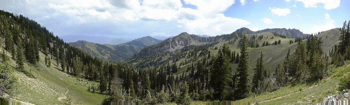
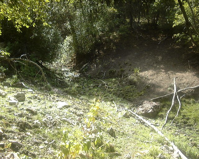
 Panorama from about 1.5 miles from the radio towers towards north and east. You can see the loose jeep road on the left of the picture
View southwest towards the radio towers from the same spot.
View west towards the lake from a turnoff nearby, which should not be taken (too early, the right turnoff is about a mile further).
Panorama northeast from the same place, the jeep trail visible in the right part of the picture.
Panorama north-east-south from the hill where the turnoff is.
Panorama north-west, Bountiful below.
Zoomed-up panorama of Bountiful and the small canyon (in the middle) that one descends.
View west down the trail that leads to Bountiful.
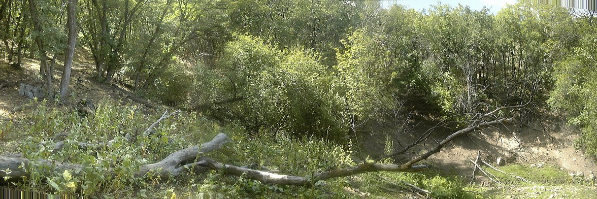
Two pictures from the descent through a nice aspen forest.
North-east-south panorama from the Shoreline trail about half way between Bountiful and the radio towers.
Panorama northern part of Salt Lake from a saddle east of Ensign Peak.
Section 2 - City Creek Cyn. to University Hospital
Trail map (500 kB)
Trail climbs out of the City Creek, then contours for a while and climbs again to a saddle with a five-way intersection above City Creek Canyon. The trail continues east, climb north-east towards the Black Mountain, north goes a trail to City Creek Cyn. closed to mountainbikes, south the famous Bobsled trail, descending down towards the Avenues district in a narrow gulch reminescent of bobsled run. Continuing east the trail contours for several miles and then descends down Dry Creek Gulch towards the University Hospital.
Section 3 - University Hospital to Emigration Cyn.
Trail map (570 kB)
The most busy section covering area above University of Utah. Most of the main trail is doubletrack, but there is a parallel singletrack a bit higher. About a mile from Red Butte Garden is a gate marking entrance to a Mormon historical state park. Fortunately, biking is allowed in the upper part of the park, with a network of short trails. My favorites are several trails heading up to the hills. One of them is the Living Room trail, which we named because it leads to a viewpoint above the valley where people made chairs out of flat rocks to sit and watch the sunset. The trail there is a wicked climb, tough types can descend directly down towards Red Butte Garden. Another climb up is a loop trail around Red Butte Garden.
Big Mountain - Lookout Pk. loop
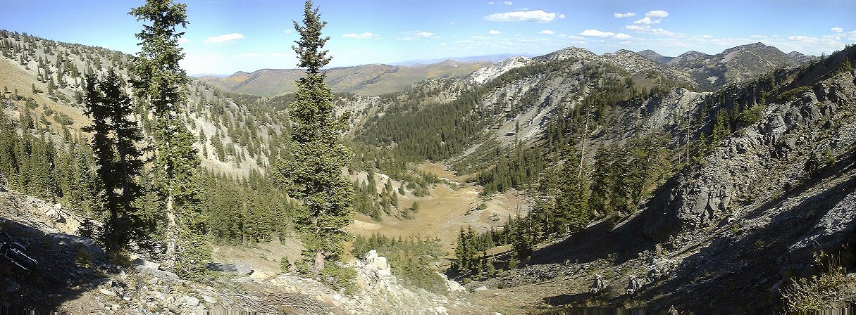
One of the wild rides closer to SLC. Gregg Bromka suggests to start in the Affleck Park in the middle of Mountain Dell Canyon, about 17 miles from downtown SLC. Me and Gary, decided, for a warm up, to start at the Emigration Canyon summit, ca. 5 miles closer to SLC. One can ride on a decent singletrack on the Little Mountain ridge towards the saddle above Affleck Park, about 2.5 miles one way. The trail was not just a moderate climb up, as it looked on the map. The second half was marked by several steep descends followed by similarly steep ascends. Not a good perspective for a way back. The ride down to Affleck Park was unevetful, I again got a chance to give a good test to my new Mars shock on a bumpy doubletrack. What followed was a 3.5 mile 1200 ft. climb to the Big Mountain Pass. We lunched there unaware of a very sucky uphill singletrack, that followed. This was the only downside of a great loop, steep, loose trail did not give much chance to get into the saddle. However, once on the ridge the fun part begun. Rocky singletrack, and then doubletrack to Swallow Rocks, and turnoff to another singletrack. Gregg says the trail after here is primitive, however, it was more used than I expected. We even met a pack of five riders on the west side of upper Mt. Dell Cyn. ridge. Here the trail goes almost level few hunded feet below the ridge for a couple of miles, and then plunges down towards the saddle between Killyon and Mt. Dell Cyns. From here we retraced our steps from the morning, arriving back to the car after 5.5 hours.
Here we have two maps. Detailed 24k map (870 kB) and less detailed 100k map (235 kB)
Fotos:
Emigration and Parleys Cyns. panorama from the Little Mountain ridge.
Panorama south from the Big Mtn. trail switchbacks, the road below, high Wasatch in the distance.
View east from the Big Mtn. climb at yet another point where I had to get off the saddle.
The trail continues up to the summit.
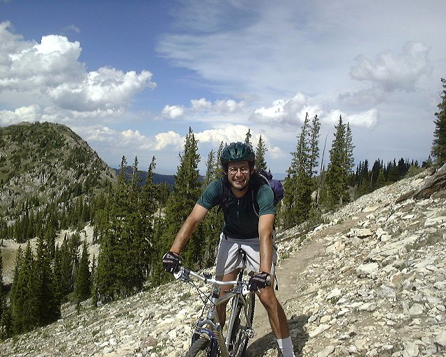
360 deg. panorama from the ridge close to Big Mtn. We came from where Gary is and continued on the ridge past Big Mtn. Note Gary's orange jacket. The hunting season is in full swing.
Second lunch break area at the doubletracked ridge, view east, Swallow Rocks in the background.
View from the same spot east where we came from.
Trail that descends from Swallow Rocks.
Ridge panorama from under Swallow rocks.
View north towards East Canyon.
Gary negotiates, in the Vancouver style, the only big obstacle on the western side of Mt. Dell ridge.
And the trail keeps on winding in the aspens.
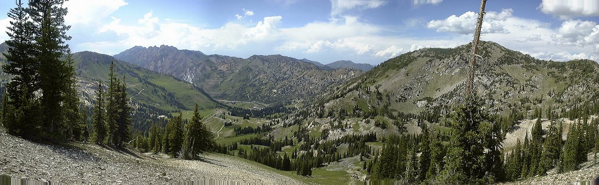
Another panorama from one of the clearings on the western Mt. Dell ridge.
Panorama of the Wasatch Front canyons before the descent to Little Mtn. ridge.
Down at the junction Killyon - Mt. Dell Cyn.
And view up at what we came from.
Gary pushing up one of the steep hills on the Little Mtn. ridge.
To be followed by another downhill.
More gentle lower ridge, views down and up.
The last shot, trailhead at Emigration summit.
Emigration Canyon - City Creek Canyon loop
Riding the Big Mountain loop for the first time, I noticed a turnoff towards City Creek Canyon. A year later, I finally found out where it goes. I rode Emigration Canyon from town and then up Kilyon canyon to the 4-way junction west of Afleck Park. Then I went up north, where one returns from the Big Mountain loop. The ride up was hard. Thanks to the hunting season, there was a lot of horse riders and the trail was really churned up. I had to push the steeper section, the rocks were too loose. The trail contouring Lookout Pk. from east was in similar shape. I breathed a sigh of relief, when I came to the intersection heading towards City Creek. I was not over yet, though. The trail more-less follows the ridge around the City Creek Canyon headwaters. I must say I was worried that there is no trail leading to City Creek. Then the trail forked. The main continued on the ridge, a faint one went down the canyon. The upper part of the canyon is not too steep, so, when the trail was not too visible, one could ride on the meadow. Then the canyon narrowed and got full of bushes. I lost the trail several times and found it again, having to hike a bit once in a while. About 2 miles down, I finally hit a more-less marked trail, which seemed to follow an old mining road. There still were a lot of bushes hugging the trail, but, at least it was a continuous ride down. About another 1.5 miles down I came to some kind of meteorologic station, from where the trail continued in similar fashion for another mile, and then turned into a gravely doubletrack. This one crossed the creek three times in about a mile, once without a bridge, and spit me out at the Rotary Park trailhead. There I noticed that upper City Creek is closed to bikes. Too late... The rest was just a 500 m vertical descent on the pavement (the descent up to there was another 600 m).
Total length of the loop a bit under 50 kms, 1400 m vertical. The climb up to Lookout Pk. is very demanding, and upper City Creek descent as well. An adventure ride at the city's outskirts.
Here is the 100k map of the whole loop (380 kB)
Fotos:
View down Emigration Cyn. nearby the 4-way intersection on the top of Kilyon Cyn.
View up to where the climb goes from the same spot.
Panorama west from a bit under half climb.
View up the trail from the same spot.
A mess left by the hunters almost at the top of the climb.
View up the trail from the same spot.
Two shots of the singletrack east of Lookout Pk..
Panoramas north-east-south from the trail under Lookout Pk.
View south on the trail that I came from.
Panorama west down City Creek Cyn.
View down the trail as it drops on the ridge towards City Creek ca. 20 m from the intersection with the Big Mtn. loop.
Two shots of the trail about 500 m. down the canyon.
The mining track as it descends on one of the steeper sections.
The meteorologic station and the trail as it comes to it.
Trail passing through a narrow section about 100 m down from the meteorologic station.
Gate with a lot of symbols at the top of Rotary Park.
Parking lot at the top of Rotary Park.
View to the northern slope of City Creek Cyn.
Mountain Dell - Parley's Canyon loop
Another suggestion from Gregg Bromka, this time from July 2001 issue of Cycling Utah magazine. This loop climbs up Mormon Pioneer Trail up Mt. Dell canyon, which is a reasonable climb except for the steeper central section. The trail starts on the left side of the road about 1 mile up from Little Dell Reservoir (= there are several miles on the road before that). In East Pass, turn south on Great Western Trail and continue climbing for a while. Then the trail levels out a bit, but there are numerous descents and ascents. The trail is sometimes smooth singletrack, but mostly covered with loose rocks. Unorthodox views from the ridge are a plus, though. In about a half of the ride comes a bit harder ascent followed by reaching the top of Bald Mountain, which lives to its name. Stop here for a while and enjoy the view. Second half of the ridge is more downhill than uphill, but there are about five climbs. The last section of the ridge is a nice and more used singletrack in a forest. Then comes telephone relay station and a rutted doubletrack down towards Parley's Pass. Before reaching the interstate, there is a underground cable line heading straight down, which I took. I am not sure if this was a right turn, but, after two steep uphills and two similar downhills, I found a trail to the left, that spit me out at a Chevron pipeline, which parallels Sheep's Trail, a return suggested by Gregg. The downhill that follows is the best part of the whole loop. Miles of smooth downhill singletrack, which follows Alexander Hollow creek. As I rode this section around sunset, there were numerous deer and several moose around, but I had to pay more attention to the trail. The trail ends with a doubletrack that leads to the Mt. Dell Canyon road, which is used to finish the loop. To minimize driving, I started at top of Emigration Canyon. The whole ride took 3:45 hr, ca. 1200 m. elevation gain, 39 kms, and 3 hrs. ride time.
Here we have the map, Detailed 24k map (880 kB).
Here is Cycling Utah July 2001 issue (PDF) whis describes the trail on pg. 3.
Fotos:
View to south-west from the end of the climb out of East Pass.
View north from the same place.
Tipped-over air beacon a bit further down the trail.
Series of panoramas from Bald Mountain.
View down on the underground cable trail from where it meets the doubletrack.
View at Parley's Summit from the top of the first climb up the underground cable route.
View down (west) from almost bottom of the second steep downhill on the cable trail, nearby the marker below is the trail left that leads to the pipeline.
Wasatch - Millcreek Canyon
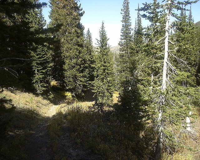
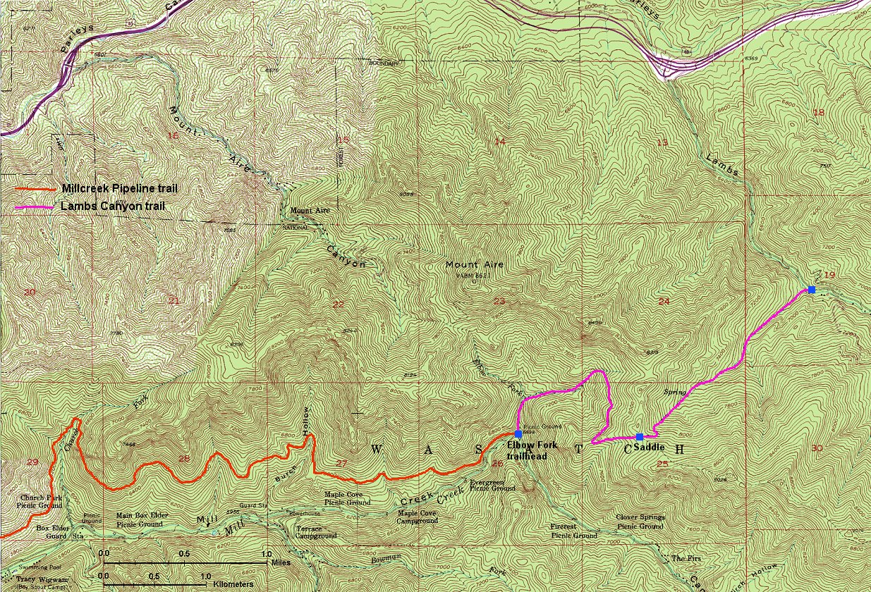
Millcreek Pipeline
Trail follows old pipeline thru about a half of the Millcreek Cy. length. Up on the road to the Elbow Fork, ca. 5 miles, then down on a singletrack, which goes mostly horizontal but occasionally drops down sharply. About 1.5 hour ride time.
A better idea than to climb up the road is to ride the Pipeline up and down, there are two big climbs on the way up, the rest is pretty flat.
Millcreek Pipeline - Lambs Canyon trail
A good 3-4 hour out-and-back ride, measuring about 30 km and ca. 1000 m vertical (starting at the bottom of Millcreek Cyn. off Wasatch Blvd.). Ride up the pipeline, at its end hop on the Mt. Aire trail, but after ca. 300 m turn right on the Lambs Canyon trail. The trail climbs about 400 m. vertical on about 2 kms, but steep parts mix with more moderate ones, so dismounting is limited only to few spot. This trail is not much frequented by bikers (judging from surprised looks of hikers that I was passing), but definitely rideable. It's about 1 hour up Millcreek Pipeline and another 30 min. up to the saddle, plus numerous rest stops. An option is to descend another 3 kms down into Lambs Canyon, and, possibly, loop going e.g. up Parley's and Lambs Canyon and down Millcreek.
Here we have the map, Detailed 24k map (600 kB), showing eastern half of Millcreek Pipeline and whole Lambs Canyon trail.
Fotos:
View east down Lambs Cyn. from the saddle on the top of Lambs Cyn. trail.
A look at a trail sign, where the trail starts descending into Lambs Canyon.
Trail marker at the saddle.
Panorama west (into Millcreek Cyn.) from the saddle.
Panorama west-north-east from a small ridge leading to the saddle.
View south-west from the same spot, the ridge is divide between Millcreek and Big Cottonwood, Millcreek Cyn. is right below.
Upper Millcreek
Here are several trails going up east and connecting to the Wasatch Crest Trail. The mountain bike are allowed only on even days. The trails are generally moderate, with some technical spots. No killer uphills like in Alta and Snowbird. The main problem is that this area us often crowded.
Here is Gregg Bromka's account on the trail.
Wasatch - Big Cottonwood Cyn
Solitude Ski Resort
Solitude has made several trails and operates one lift during the weekends. This means that the trails get messed by the downhillers by mid summer. All the trails can be ridden in several hours, without using the lift. I rode up the lift service road to the top of the Summit lift (the last stretch if very steep, I had to get off several times), and down on the singletrack to the bottom of the resort (quite nice trail). Another downhill singletrack starts just below the Roundhouse restaurant.
View from the top of Summit lift to the Twin Lakes reservoir and Brighton.
Wasatch Crest Trail - as a loop
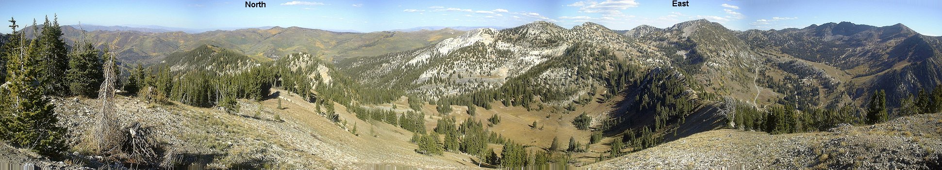
Me and my bike partner Gary share an idea to avoid car shuttles as much as possible. I rather sit on the bike than in the car. To do this loop, park the car at the Mill D North trailhead in the middle of Big Cottonwood (ca. mile 10) and bike up the road up, turn off to the Guardsman Pass road and then go to the Smith's Pass trailhead. This is about 8 miles road ride, but that's what the roads are for. Then there is further mile or so climbing, but this is already on the official Wasatch Crest trail. This is followed by miles of rolling singletrack. For those tired, one can turn off down towards the Desolation Lake. The crest contiunes further, and then drops into the Millcreek Canyon. After a couple of miles of downhill, turn left towards the Dog Lake (does not have this name in vain, we saw tens of dogs swimming there during the ride - the water looked worse that sewage). What follows is a seemingly endless climb aggravated by tired legs. From the Dog Lake, it is just downhill via Mill D North to the car. Don't forget that Millcreek Cyn. allows bikes only on even days. Doing the Desolation Lake shortcut one stays all time on the Big Cottonwood side so this can be done any day.
Here is a trail map (150 kB).
Here is Gregg Bromka's account on the shuttle version of the trail.
Fotos:
On the top of the crest climb, looking towards Brighton.
Panorama from the same spot (200 kB).
Above Desolation Lake. The trail right of the lake is the above mentioned shortcut.
Ridge above Desolation Lake looking north.
At the trailhead after the ride.
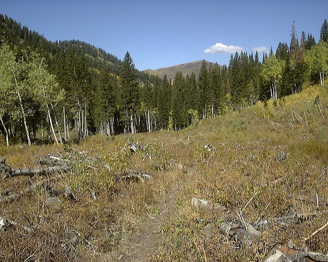
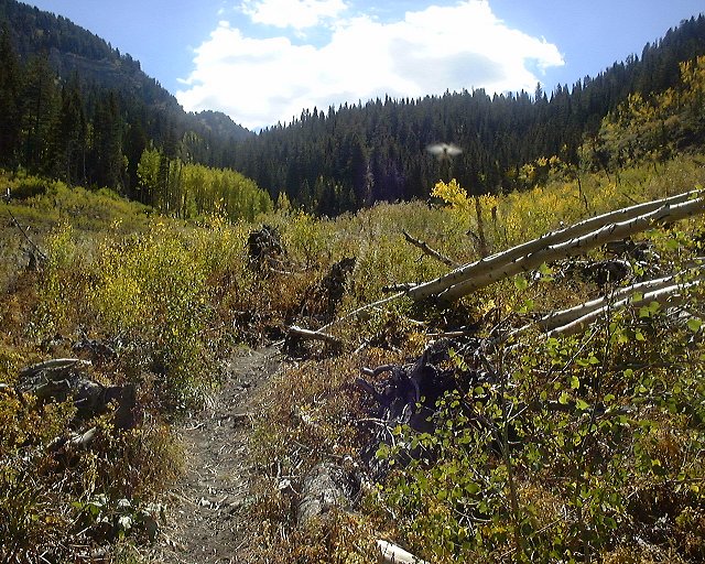
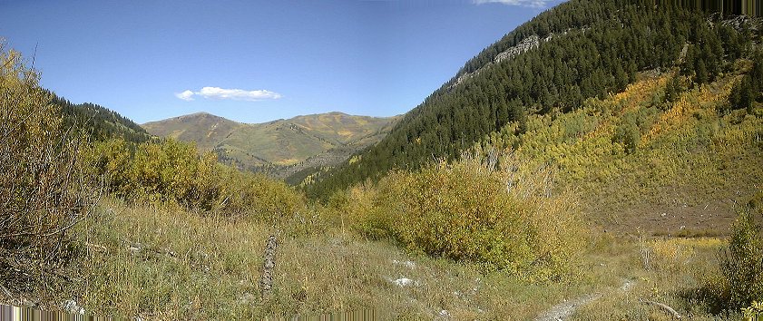
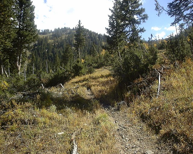
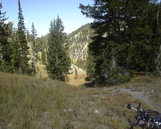
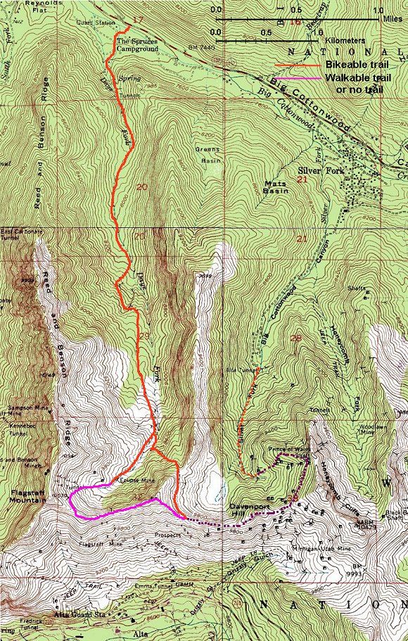
Days Fork (with possible extension to Silver Fork)
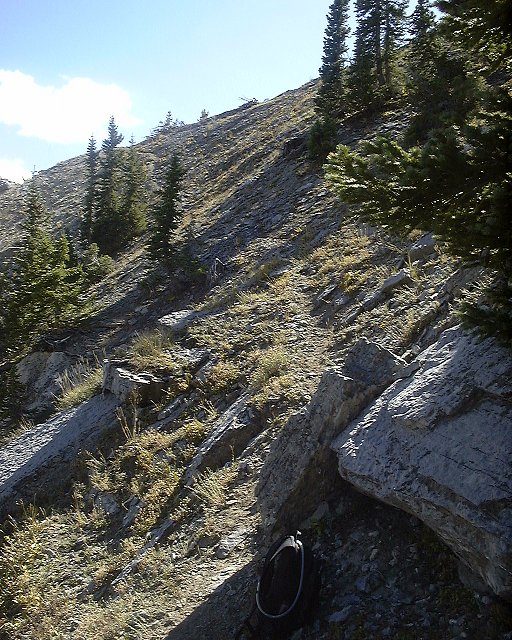
Days Fork starts at the Spruces Campground in the middle of Little Cottonwood and climbs up south. There is a singletrack on an old mining road all the way to the Eclipse mine, mostly rideable, with several vicious climbs. Few hundred meters below Eclipse, there is a singletrack veering off left and up, which leads on a ridge between Silver Fork and Days Fork, and is a good ride down, but probably some pushing on the way up. Since I did not notice it while riding up, I ended up pushing my bike through the upper Days Fork meadows and up to a ridge right below Flagstaff Mountain. I was hoping on being able to ride the Cottonwood Ridge east from Flagstaff towards Silver Fork, but most of the ridge is not rideable, and on many places there is sharp gravel that punctures the tires easily. I descended on the singletrack mentioned above, that starts in western Silver Fork, stays on the ridge and then plunges into Days Fork. The descent down Days Fork was fun, making up for the tough climb, although my arms were numb when I got to the bottom. In the works is to find a way how to connect Days Fork with Silver Fork.
Here is a map (300 kB).
Fotos:

 View up and down the trail about 1 mile up.
 Panorama down the trail about 1.5 miles up.
 View up the trail before one of the worse climbs.

 View up and down the trail another 500 m. up.
 View down the trail about 300 m. below Eclipse Mine and right before the turn towards Silver Fork.
 Panorama up from the same spot.
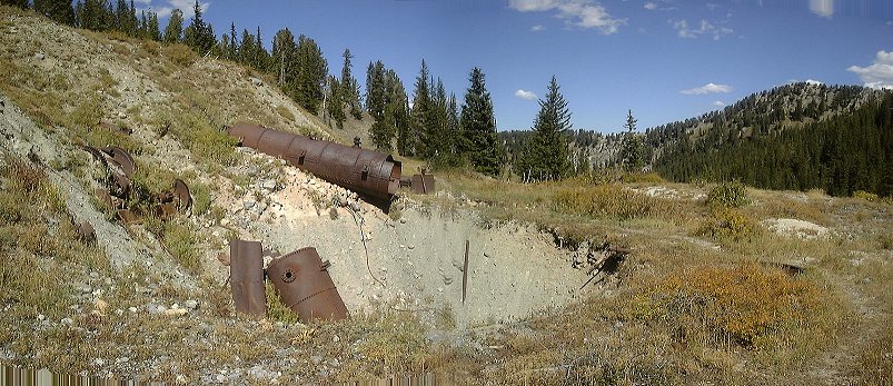
 Remnants of an old boiler from the Eclipse mine.
 Upper Days Fork. I walked up on the central-right of the picture.
 View down Days Fork from about 50 m below the Cottonwood Ridge.
 Look at the trail at the same spot (I walked this one, bike on the back). There were more mountain goat than people's tracks on the trail.
 Almost 360 deg. panorama from a knob below Flagstaff Mountain.
 Panorama towards Silver Fork from a hill west of it.
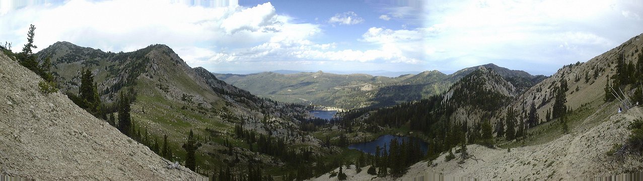
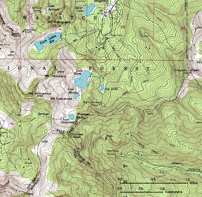
Brighton to Alta and back
Brighton offers several uniteresting (and steep) lift service roads, and a network of hiking trails, which can be ridden with some effors (and occasional dismount, when the trail gets too bouldery). For those, who don't mind walking, a good one is to ride up to Lake Mary (the last section before the lake requires walking), and then continue up to Lake Catherine and Catherine Pass, which divides Brighton from Alta. From here, one can continue south and east to a saddle under Sunset Peak, from which goes a ridge trail towards the top of Alta's Sunset lift. From here, take the lift road down to the Albion Basin campground and another 1/2 mile on the road down. Then turn left onto the Catherin Pass trail, which climbs to the pass, and is in reasonable shape (requiring only small amount of pushing). Return back to Brighton the same way on a fairly technical downhill.
Here is a map (280 kB).
Fotos:
 View from the top of Summit lift to the Twin Lakes reservoir and Brighton.
 Panorama from the pass west of Sunset Peak south, Mt. Timpanogos faintly visible in the background.
 Me on the ridge trail from Catherine Pass to top of Sunset lift.
 Panorama from top of Alta's Sunset lift north-west, into Albion Basin.
Wasatch - Little Cottonwood Canyon
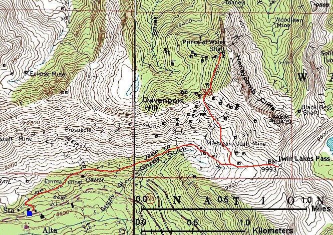
Grizzly Gulch
Old mining road that goes from Alta east towards Brighton. It is moderately steep most of the time but there is couple of rough spots with loose rocks which require pushing. About 1/2 mile below the Twin Lake Pass (end of Grizzly Gulch), there is a old mining track left (north) which leads to the Prince of Wales mine, a nice mile or so of singletrack.
Here is a map (200 kB).
Fotos:
Fixing a bike on the top of Twin Lakes Pass.
Misha on the last stretch towards the Prince of Wales mine.
Going down on the worst rocky section.
Germania Pass
In Alta, the trail goes on a gravel road kept by the skiing resort. From the bottom of Alta is is about 5 km to the Germania Pass, 1800 ft. elevation, then down the other side of the pass, total ca. 15 km, ride time max. 2 hours.
On the last August Saturday 1999, me and Aaron rode our mountain bikes from the bottom of the Little Cottonwood Canyon (ca. 1600 m) to the top of Sugarloaf Lift in Alta (ca. 3200 m) and then hiked to the top of Mt. Baldy (3374 m). Another friend Justin joined us for a ride from Alta up and on the hike. On a fun side. I was so trashed on the top that I forgot there a lock that we used to lock the bikes while hiking to the Baldy. First time I was back there, almost 11 months later in mid July 2000, I found the lock and it was working perfectly. Good I have saved the keys.
The three of us on top of Mt. Baldy, view to the West, one American Fork Twin (the higher one) and Pfeiferhorn in the distance.
Me and Aaron with the bikes in the Sugarloaf saddle, Albion Basin in the background.
Me and Aaron with Mt. Timpanogos in the background.
Hidden Peak
The highest point reachable on the bike around SLC, 3251 m. Access via a gravel road belonging to the Snowbird ski resort. About 5 km long, elevation gain about 2500 ft., it took about an hour to get up, 15 min. down.
White Pine Lake Trail
Former jeep road, now used only by hikers and bikers, so it is quite rocky. I had to push several times. Length about 9 miles roundtrip, elevation gain 2460 ft., ride time min. 3 hours.
My bike and the lake, Broads Fork Twin Pks. and other peaks between Big and Little Cottowood in the background (225 kB).
Alta - Sugarloaf Pass - Mineral Basin - Hidden Peak Supertour
With White Pine probably the worst which can be done in the Little Cottonwood. From the upper Alta lifts it is about 6 km, 550 m. vertical up to the Sugarloaf Pass. From here leads a trail south down to the Mineral Basin. Unfortunately, only about 60% is rideable, the rest is very loose because of ATVs. Down it is about 300 m vertical, a couple km long. From Mineral Basin goes a new lift service road up to the saddle east of Hidden Peak and from there up to the summit (or better to say to a building that houses top of the Snowbird tram). This can be about 450 m. vertical, 3-4 km long. Then follows a wild ride down and up the road back to Alta.
Total elevation climbed is about 1000 m. length ca. 18 km, ride time a bit over 2 hours.
Here is a map (350 kB).
Little Cottonwood Pipeline
Short trail, going up the canyon about 6 km from the canyon base. Elevation gain is about 250 m. After about 5 km there is a connection trail to the L.C. road. The trail is mostly moderate uphill with packed gravel or sand, however, there is several steeper sections with embedded rocks, which require some concentration and technique.
Here is a map (150 kB).
Oquirrh Mountains
Yellow Fork of Rose Canyon
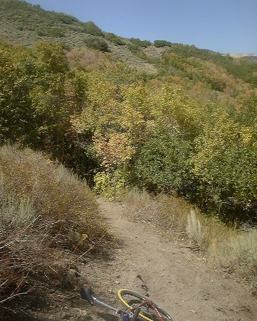
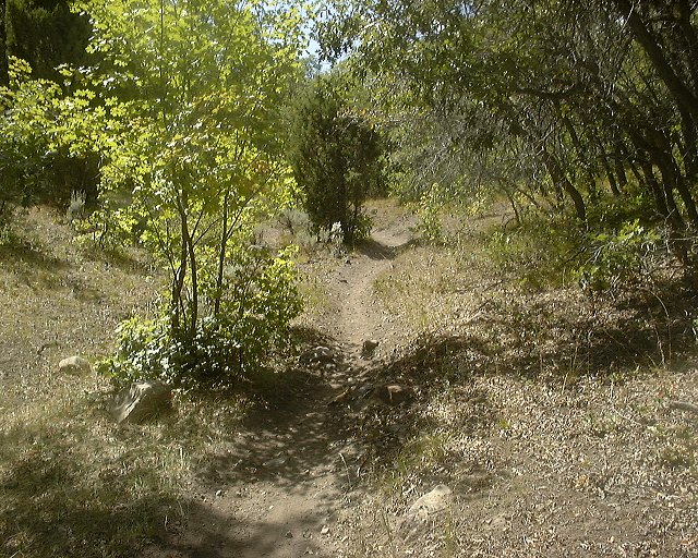
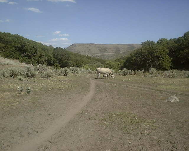
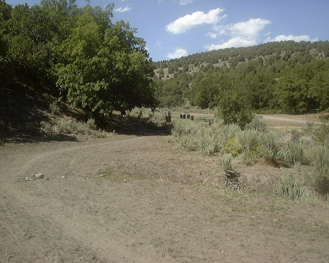
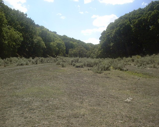
A piece of central Utah at Salt Lake's doorstep. The trail climbs a singletrack along a creek partially trashed by horseriders and cows, surrounded by oaks and junipers. Main trail is marked by orange rectangles on the trees and lined by empty beer cans. Once you stop seeing both, you are on one of the numerous side trails that in better case end up by a steep uphill. On a positive note, the level of trashing exponentially decreases with distance from the trailhead, making the upper parts of the trail quite enjoyable. Once you get on the treeless ridge (taking the last fire road climb), turn off right at the top of the road for a great piece of singletrack that goes all the way down to the main fork.
I got a tip on the trail from Utahmountainbiking.com.
Here is a map (450 kB).
Fotos:

 Two views at the trail winding along the main Yellow Fork drainage.
 Spring in the left fork of the main canyon along which goes the wrong trail.
 Another view at the spring. If you get here, go back about 150 m. until you see a picnic area on the left (across the creek).
 Wrong trail as it emerges from the forest at the ridgeline.
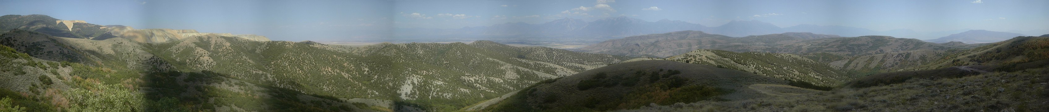
 Panorama east from the top of the road. Copper mine on the left, the Wasatch in the distance.
 Smooth downhill singletrack in the other fork.


 Trail intersection in the lower part of the canyon.


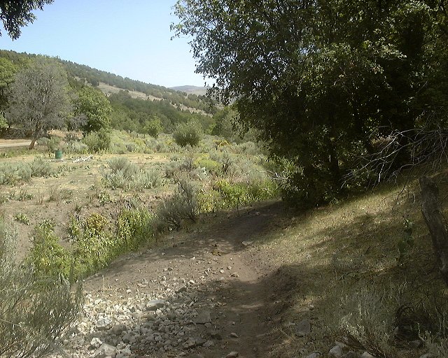
 The trailhead at the end of the paved Rose Canyon Road. Horse poop everywhere.
Combo/epic rides
SLC to Big Mountain Pass, Parley's Summit and back
A pretty decent epic ride from the Avenues up Emigration Canyon and East Canyon to Big Mountain Pass, then on Great Western Trail to Parley's Summit, down Alexander Hollow, then on the road back to Emigration Canyon road and back. Here is map and fotos.
Lambs Canyon - Millcreek Canyon connection
An attempt to explore connection from Lambs Canyon to Millcreek turned out into quite an epic that's worth repeating. Here is map and fotos.
From Salt Lake to Bountiful and back
A nice fall ride starting from the Avenues, on the Shoreline trail to Bountiful, up and down Muller Park and back on Shoreline home. Here is map and fotos.
U of U / CHPC / Cuma / Mountain Bike / Central Wasatch Front
URL:
http://www.chpc.utah.edu/~mcuma/bike/ut_cent_wf.html


