Flat Top - Temple Mountain loop
Iron Divide Trail System
Devils Racetrack
Oil Well Flat - North Coal Wash - Devils Racetrack - Cane Wash grand loop
Black Dragon Wash
Temple Mountain loop
Basically a subsection of the loop below. Started at the end of pavement on South Temple Wash road, biked up for about a mile, turn off and loop around Temple mountain. Whole loop is about 11 miles, mostly on doubletracks. I missed the turnoff from the South Temple Wash and ended up going back down South Temple Wash till the correct road for about 3 miles, which was the most exciting part of the ride.Flat Top - Temple Mountain loop
I did this loop in mid March during a weekender to the area. Here is the map of the loop (190 kB).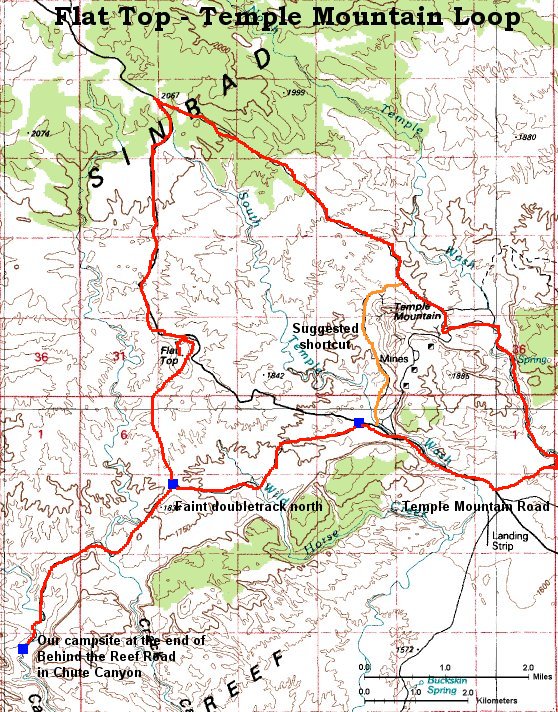
We got our bikes ready and biked north on the Behind the Reef Road. The only companion that day was a lone motorcyclist. I soon turned west and on a jeep road reached the Flat Top Mountain, about 8 miles west of Temple Mountain, about the same height, but as the name suggests, pretty flat. There is an old mining road that goes all the way to the top, the last piece is cut through the slope,
 and there, plus on most western slopes, were remnants of the Thursday's snow storm. In fact, it was still pretty chilly that day. I had a lunch on the top, and took bunch of pictures. Here are two sets which I collected into a panoramatic view: view to the west-south
 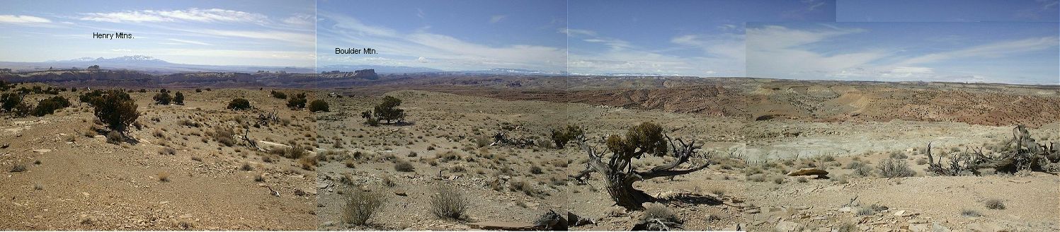 (150 kB) with the higher parts of the Swell, and view to the south-east-north
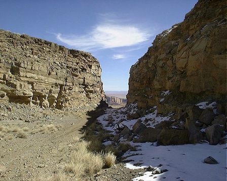
 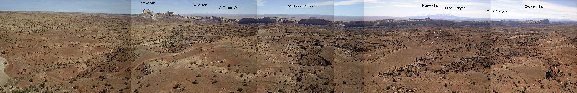 (200 kB) with the overall Reef view. Then I continued north-west and up on the dirt road that leads to I70. Near the summit, I off turned east on another jeep road, towards the Temple Mountain. At the beginning, the road looked something like this
 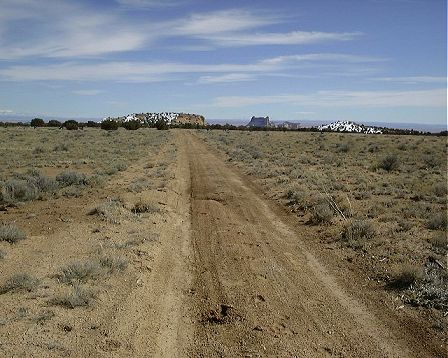 , more-less packed dirt, but there were two wet sections from the melting snow, which made the dirt into a 5 cm thick glue-like stuff. The bike was covered in a few meters to an extent that the wheels would not move anymore. I had to carry it through these sections. A word of advise, if you go to bike in this area, make sure the roads are not wet. Once I got to lower elevations, the snow disappeared and the ride was a pleasant gradual downhill with few rougher spots. With the north side of Temple Mountain
 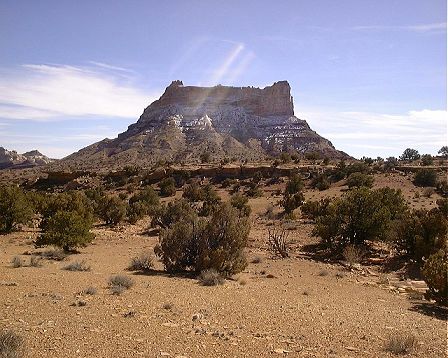 in view, I stopped for a while to clean the mud that did not fall off during the shaky ride. Another few miles down, in the cirque behind Temple Mountain (which displays remnants of the minig activities
 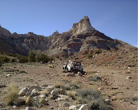 ), I unsuccessfully tried to cross the mountain ridge, although there were roads marked on the map. One of the roads that I took up a bit seemed to be covered by a scree avalanche, so this might have been the one shown on the map. So, I had to go more east, cross the reef in the North Temple Wash, and on the road thru South Temple Wash and Behind the Reef got back to the campsite, by end of which I was pretty tired. Still, this was an enjoyable ca. 5 hr. 55 km ride. For those interested, though, I would suggest to take the jeep trail west of Temple Mountain back to the main road, one does not miss much of the cool stuff and shortens the ride by good 10-15 km.