I-80 west of SLC cuts through several mountain ranges that form the eastern edge of Great Basin. Each of these ranges have numerous dirt roads going through or around them. I am slowly exploring the area, which is the best to visit in spring or fall, it's too hot in the summer. There's also several official singletrack trails in the area.
Click here for overall map of the area.
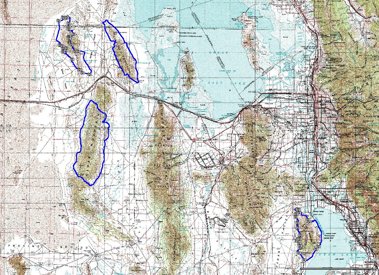
A ride from Gregg Bromka's Wasatch guide book. Mostly smooth dirt roads. Cedar Mountains are west of Stansbury Mountains. An added attraction is herds of wild horses, that can be seen from the roads. For details, map and photos see this page.
A bit more adventurous option with less driving on the dirt (start closer to I-80) is to do the loop counterclockwise and include less explored jeep roads that loop around the northern edge of the Cedar Range. For details, map and photos see this page.
Lakeside Mountains border the Great Salt Lake from the west, just north of I-80. I devised this loop from consulting topo maps and aerial fotos. For details, map and photos see this page.
Grassy Mountains are west of Lakeside Mountains and north of I-80. Initial idea for the loop is from Gregg Bromka's book, which I spiced up with some more climbing after consulting topo maps and aerial fotos. For details, map and photos see this page.
Areas southwest of SLC are best reached via I-15 to Utah Valley and then going west on one of the state roads. No official trails in the area, just dirt roads, although, supposedly, there's a race course near Fivemile Pass west of Lehi.
Pony Express Trail - section 2Biked this part on a rainy February day. The original plan was to ride from a small town (several houses) called Faust, ca. 20 miles south of Tooele, west on a dirt road part of Pony Express Trail. However, rain turned the soil to a glue, so we turned around and rode east on the pavement for good 15 miles to Fivemile Pass on the southern end of Oquirrh Mountains. Quite a nice winter ride, on a narrow road with little trafic.
Lake Mountains are west of Utah Lake. Access is easy from I-15 in Lehi towards Fivemile Pass and then south along the west side of Utah Lake. I modified Gregg Bromka's loop by skipping climbing to the top since there was still snow there. A disadvantage, due to proximity of urban areas, is that there were some ATVers and shooters in the area. For details, map and photos see this page.